The second of our two-part local walks series looks at easy walks just outside the district heading just north of the Rakaia River, or just south of the Rangitata. Sharon Davis has compiled her top list of scenic walks – the perfect way to include an immersion in nature and healthy exercise into your holidays.
Heading north there are some picturesque walks at the Rakaia River and turning in toward Lake Coleridge. Access is often over private land and dogs are not allowed on any of these walks.
Rakaia Gorge Walkway
The Rakaia Gorge Walkway is an easy 10km walk through forest and bush with interesting geological features and picturesque views. The track passes the old Snowdon coal mines and has a loop at the end, with an option to take a short track down to the boat landing point on the river.
Nearby: Enjoy the stunning scenery and turquoise waters from a jet boat instead with Discovery Jet or pop into Mt Hutt Lodge, literally just a stone’s throw away, for lunch.
Track: Easy walking track with an alert for some slips on the track.
Lake Coleridge
Turn onto Coleridge Road at Windwhistle. If you don’t feel like walking far this can be turned into a scenic drive for a picnic at any number of pretty lakes – or stop in at The Clubhouse at Terrace Downs for a cuppa or a bite to eat.
Peak Hill
Peak Hill is on the harder side of walks on this list with a climb of over 600m in just over 2km – but the views are totally worth the effort. The route is well marked but the track is rough in places and the route is exposed to the elements.
Access: Access starts over private land on Algidus Road.
Turn up the heat: If you’re looking for something longer there is an unmarked track that continues over Peak Hill, down the far side and loops back at the base of the mountain. Route-finding skills are recommended for the loop. The views from the other side of the hill are worth it, but the track is overgrown on the lower slopes and otherwise unremarkable.
Track: Well-marked but steep track with a few slippery sections.
Lake Ida
Lake Ida is on my list of the top six scenic walks in Canterbury. I love the range of scenery from lakes to huge vistas with an unusual view of the back of the Craigieburn Range and Mt Olympus. I rate it highly for the scenic reward for the effort expended. There are a few smaller lakes to explore around Lake Ida.
Access: The Ryton Track runs on private land from Harper Road between Lake Evelyn and Lake Selfe. It is roughly 3km (one way) to Lake Ida. The lake is popular with fishermen in summer and ice skaters in winter.
Turn up the heat: For a longer walk continue to Lake Catherine (add 2.5km one way). Part of this section has recently been re-routed and no longer follows the trail marked on the map. To really turn up the heat follow the Ryton River up an unmarked route to the summit of Mt Cheeseman. Note this last option is a hard route suitable for advanced trampers with the right gear.
Track: The Ryton Track has a few ups and downs but is relatively easy walking around the base of Little Mt Ida on a rough but well-marked trail. Track markings become sparser around the base of Mt Ida toward Lake Catherine.
Up the Harper River
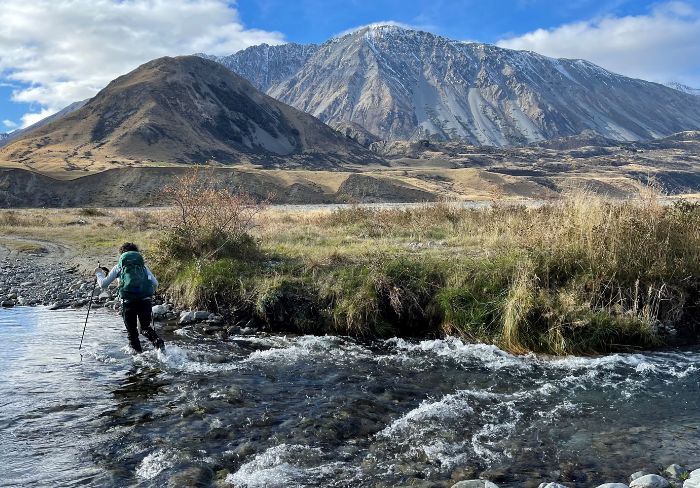
We followed a mix of a 4WD track and the Te Araroa Trail up the Harper River and walked into Lake Lilian. Apart from losing the trail when it left the 4WD track it was 20-odd-km of boring walking (return) through absolutely stunning scenery. I loved it for all the oh wow and look-at-that moments but found the walking route either on the vehicle track or following a fence line detracted from the experience.
Access: The route is on private land from Harper Road. Check the public access section of Glenthorne Station’s website for the latest access information.
Turn up the heat: Continue to Lake Lilian or carry on up to Hamilton Hut for an overnight trip.
Track: Flat walking on the 4WD track with the option to walk as far as you feel like going. The turnoff toward Lake Lilian is not clear and parts of the track are boggy and can be hard to follow. From there it follows the fence line before turning off to the Lake Lilian Walkway. The final stretch to the lake had a few slips.
Dry Acheron Track
The Dry Acheron River is a misnomer, so expect at least the possibility of wet feet. The walk is on private land. It starts along a shelter belt before heading upriver with covenants to allow access to areas such as Clay Gully and Conical Knoll. It is a pretty walk with some lovely river sections but not spectacular. It is under 6km to the weir (one way) on mostly flat land but comes with the caveat that river hopping uses more muscles than you think.
Access: There is a small car park that is easy to miss on Coleridge Road. Follow the track, use the stiles and leave gates as you find them.
Turn up the heat: For a longer and much harder walk you can head up the Big Ben route. From here it is a poled route for advanced trampers.
Track: Easy farmland walking to the river. Once at the river, it is a mix of following the river and climbing the banks on other sections which can be harder to follow.
Washpen Falls
Washpen Falls is a 4km loop walk on private land through varied terrain to picturesque falls in a canyon. A fee ($10 for adults and $5 for children under 15) is charged for the upkeep of the track. Allow about three hours at a relaxed pace to enjoy the many sights.
Access: From the old woolshed at Washpen Falls on State Highway 77 between Windwhistle and Whitecliffs.
Track: Generally an easy track with some ups and downs and the odd slippery section.
Tenahaun Track
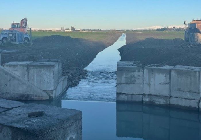
The Tenahaun Track offers gorgeous views of the Rangiata Gorge. The track starts near an irrigation canal and is on an easement through private land. The track climbs a little up the base of Mt Pukanui above a gorge section before dropping back toward the river.
Access: From Klondyke Terrace near Montalto. This road continues to the Rangitata Diversion Race intake at the Rangitata River. A public access easement starts from this point.
Turn up the heat: Carry on and access the Moorehouse Range via Browns Saddle.
Track: Shared walking and biking track covering 9km (one way). Allow about six hours.
Little Mt Peel
Little Mt Peel is the hardest of the listed walks and is a solid day walk up into alpine terrain with magnificent views for the effort of climbing more than 900m. Deer Spur Track is just over 9km return and follows a ridge to the shelter at the summit at 1311m. Allow six to eight hours for the return trip unless you do this sort of thing every weekend.
Access: Deer Spur track from Blandswood in the Peel Forest Park is the easiest route up Little Mt Peel.
Turn up the heat: Make it into a loop track and return by the South Ridge Track. This is a harder route with some rock scrambling. If you really want to turn up the heat you can follow the ridge to Middle Mt Peel or further. This is an advanced option.
Track: Steep track with some boardwalk sections.
Fern Walk
Peel Forest has 68 species of fern with many of these along this track. The route passes through the virgin podocarp forest of Mills Bush with large tōtara, mataī and kahikatea trees.
Access: Either Te Wanahu Flat or Blandswood in the Peel Forest Park.
Track: Easy 3.3km track with some tree roots. Allow 90 minutes.
Turn up the heat: If you’re a tree and vegetation buff, add on the short Big Tree Walk to see a large 3m-wide tōtara or join the Fern Walk with the Allans Track to create a loop.
Talbot Forest
Talbot Forest is the only dog-friendly option on this list. There are four easy trails to choose from with tall trees and birdsong. Try the (almost) 4km loop track for a good leg stretch.
Access: From Tripp Street.
Track: Easy track – allow about an hour.
By Sharon Davis


